The well at the cottage sometimes is the only source of drinking water and want to see the quality of the water in it was good. Therefore, in the search for water you need to know at what depths are the best bearing layers. To reach them, we need to explore the entire site and to choose the place. Consider how to find water for wells in a variety of ways.
The contents
The location of the aquifers in the ground
The water in the earth is maintained due to the confining layers that do not let it either to the surface or more deeply. The main component of the layers is a clay, which is highly resistant to moisture. Sometimes there are stones. Between the clay layers is the sand layer that holds clean water. This is the aquifer, which should be reached in the process of digging the well.

Clay layers securely hold the bearing layers
In some places sandy lived can be thin, in others of enormous size. The largest volume of water produced in the ground breaks the waterproof layer, which is not strictly horizontal, but with the elevation changes, curves. And where clay makes the curvature changes the direction of the height, get kind of breaks that are filled with wet sand. These places are so saturated with water that they called «the underground lake».
It depends on the quality of water from the depths?
In the digging of the well can be found in aquifers mine very quickly – already in 2-2,5 metres from ground level. Such aquifers the water for drinking to take undesirable. Because of the proximity to the soil surface in the mine to penetrate from the top of the water rain, melting snow, sewage, water pollution and significantly degrade its quality. Specialists these superficial veins are marked by a special term – perched. Moreover, these layers are rather unstable. If the summer is hot and no rain, water from lakes trolling rod disappears, and hence in the well it will be gone. So in the «peak» summer season vacationers can stay without water, and until the autumn.

In the vadose comes a lot of dirt and chemicals from the soil surface
The optimum depth at which you wish to retrieve water for the well is 15 meters. At this depth the line passes, mainland sand, containing very large volumes of water. A significant thickness of the sand layer helps to maximize the cleaning of water-bearing veins of all kinds of garbage and «chemistry».
Search bearing layers the methods of observation
To find water, not necessary to invite specialists. For many centuries people in the villages treated on their own using observation of nature and animals.
Monitoring fog
In the warm season early morning or late afternoon inspect the area. Where near groundwater near the ground produces fog. And his consistency you can determine how deeply located aquifers lived. What the fog is thick, the water closer. Fog, caused by rising ground moisture, does not stand still, and go clubs or trail the soil.
The behavior of animals in heat
Field mice will make nests on the ground, if the water is close. They carry their homes on tall plants, tree branches.
If the owner has a dog or a horse, in summer, when sintering, it is necessary to observe their behavior. Thirsty horses begin to look for water in the soil and the beat of the hoof at the place where the high level humidity. Dogs try a little «to shoot down» body temperature, so dig in wet areas of the pit and hiding in them. The moisture evaporates, it cools the land, so animals and strive to lie down at these points.

Dogs feel close to the water and dig in the hole to take refuge from the heat
Poultry is also a good indicator. The chicken won’t lay, and where she feels the proximity of water, but the goose specifically chooses locations where aquifer cores.
In the evening, when the heat subsides, you can watch the midges. They start off in groups and form «columns» over the most humid places of the site.
The range of plants-indicators on the site
Long about the depth of the aquifer, the man informed the plants. Dank will never live in places where the groundwater is very deep. But if the country vengeance is rampant mother-and-stepmother, Hemlock, sorrel, nettle, hence, soil moisture is sufficient.

For a growing cottage plants, you can determine at what depth the aquifer is lived
Alder, willow and birch grow well in wet soils. If the crown is tilted to one side – so there should search for the aquifer. Never grow well in areas with close groundwater level of Apple, cherries. Gather all the falling fruit will rot, and the tree – rooting.
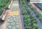
Practical methods of finding water for a well
In addition to observations, for searches you can use different devices. Consider how to find water for a well with items.
We arrange glass jars
In the morning put around the area of the same size glass jars, turning them to the ground by the neck. The next morning check which was condensation. The more, the closer the aquifer.
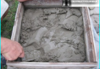
Spread salt or brick
Wait for a few days no rains fell and the soil became dry. Take dry salt or granulated into small pieces of red brick, put in a clay pot (unglazed). Weighing written testimony, zamatyvaem all in cheesecloth or spandex and buried in the ground on two feet. A day later, take out the pot, remove the material and re-weighed. The greater the difference in mass, the closer aquifers lived. By the way, modern blagonamerenny suitable silica gel.
Indication aluminum or losowymi framework
Method 1:
- Take two pieces of wire made of aluminium 40 cm and 15 cm bent at right angle.
- Insert them into a hollow tube (preferably cut from the elderberry and remove the core).
- Check that the wire is freely spinning in the tube.
- Take both hands on the tube and go to the site. The wire ends should be deployed left and right. If under the feet of the aquifer will be a live – wire converge towards the middle. If the water is found to the right or left of the man – the ends of the wire will turn in that direction. Aquifer once mine passed the wire back again in different directions.
- The best place to clamping of aluminium, walk again, but perpendicular to the direction in which initially moved. If the closure was repeated – there and dig a well.
2 way:
- Cut from the vine the branch where on one trunk two forks going at an angle of 150 degrees to each other.
- Bring home and dry.
- Come to the country, taking in both hands the ends of the branches to the trunk turned out in the middle and pointing upwards.
- Go to the site. As soon as the trunk is bent to the ground – there is hardly any water.

Raised up the trunk of the vines bent to the ground, as soon as you feel close to the water
Wicker and aluminium give a signal that the ground water there, but it can be bleak, which is not suitable for the well. Therefore, after ascertaining the wet areas conduct pre-drilling to understand how deep is the aquifer.